


Top > In the News... > MN DNR Minnesota Fish Range Mapping Application
 |
The Minnesota Department of Natural Resources requests feedback from teachers on a new Minnesota Fish Range Mapping Application being developed that will be available on the MN DNR website when it is completed.
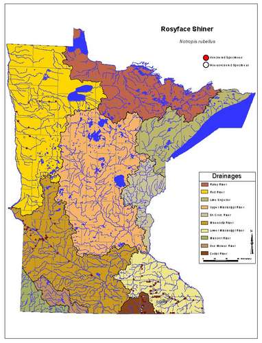
The Minnesota Department of Natural resources is proposing a mapping application that will be available on the DNR web page. Feedback from teachers in science, technology and social studies areas is being sought by the application developers in order to help make this a useful tool a classroom teachers, too. The site will have many of the same features available on the WI DNR web site, but will have an appearance similar to the map above.
Specific recommendations we request comments on include:
- Additional layers/background maps
- Additional graphical representation besides data points (e.g.,
- lakes, streams, watersheds, counties)
- Shape file export of user's query
- Related links (e.g., Fishes of Minnesota)
In addition, please don't hesitate to add something we have not considered.
MN DNR contact person:
Konrad SchmidtIchthyologist
Dept of Natural Resources
Ecological Services Division
Box 25
500 Lafayette Rd
St. Paul, MN 55155
651-259-5137
If you have any other questions, please contact either Konrad Schmidt or Michelle Kelly, MinnAqua Program
 Minnesota science teachers should know about: